Oklahoma is known for wind and hail, but water causes its own share of damage. Heavy spring storms can turn a dry creek into a fast-moving channel, and low ground on an otherwise good parcel can hold water for days. Before you build a barndominium, check Oklahoma floodplain maps for the parcel and look closely at how water moves across the land. This guide explains how flood zones work, what building in a floodplain involves, and the drainage questions that shape where a home, shop and driveway should go.
Why Flooding and Drainage Matter for Oklahoma Barndominiums
Barndominiums are often built on rural acreage, and the best views or the flattest ground are sometimes closest to a creek. Those same areas can be the first to flood. Even outside a mapped flood zone, poor drainage can push water against a slab, wash out a driveway or soak a septic field.
Oklahoma’s rainfall also varies widely. The Oklahoma Climatological Survey reports average annual precipitation of roughly 17 inches in the far western Panhandle and around 56 inches in the far southeast. A drainage plan that works on dry western acreage may not be enough on a wet parcel in the east.
How to Read Oklahoma Floodplain Maps
Flood maps show where the risk of flooding is highest. The main federal source is FEMA’s Flood Insurance Rate Maps, which you can search by address through the FEMA Flood Map Service Center.
The key terms to know are:
- Special Flood Hazard Area: land with a 1% chance of flooding in any year, often called the 100-year floodplain
- Base Flood Elevation: the height floodwater is expected to reach during that 1%-annual-chance flood
- Flood zones: labels such as Zone A or Zone AE for higher-risk areas, and Zone X for moderate or lower risk
- Floodway: the channel and nearby land that must stay open to carry floodwater
A “1% annual chance” sounds small, but over the life of a home it adds up. It is also an average, not a schedule, so two floods can happen in back-to-back years.
Using the FEMA Flood Map for Oklahoma Properties
When you look up a FEMA flood map for an Oklahoma property, zoom in to the building site, not just the parcel. A flood zone may cover only a strip along a creek, leaving higher ground outside it. Also check the map date, because older maps may not reflect recent development or updated studies.
Oklahoma floodplain maps can also differ at the local level. Tulsa, for example, keeps its own regulatory floodplain maps that are more conservative than FEMA’s. Always ask the local floodplain administrator which maps apply.
Who Regulates Floodplain Development in Oklahoma?
Floodplain rules in Oklahoma are set and enforced locally, with state coordination. The Oklahoma Water Resources Board is the state coordinating agency for the National Flood Insurance Program. It reports that more than 400 Oklahoma communities participate in the program.
Under the Oklahoma Floodplain Management Act of 1980, cities, towns and counties can adopt floodplain regulations and create floodplain boards. Each participating community has a floodplain administrator, who must be accredited through the OWRB. That person reviews development in the floodplain and issues floodplain development permits.
Can You Build in a Flood Zone in Oklahoma?
Often yes, but not without extra rules, cost and risk. Building in a floodplain usually requires a floodplain development permit from the local community or county, in addition to any building permit.
Requirements commonly include:
- Raising the lowest floor to or above the Base Flood Elevation, plus any extra height the community requires
- An Elevation Certificate prepared by a surveyor or engineer
- Limits on fill and grading that could push water onto neighbors
- Strict limits or prohibitions on building in the floodway
Building a house in a flood zone also affects insurance. Lenders generally require flood insurance on federally backed mortgages when the home sits in a Special Flood Hazard Area. That ongoing cost should be part of the decision, not a surprise at closing.
Why Avoiding the Floodplain Is Usually the Better Option
On a large parcel, the simplest answer is often to place the home and shop on higher ground outside the mapped flood zone. That can reduce permit requirements, insurance cost and risk. Land selection and evaluation support is most useful at this stage, because it helps confirm whether a usable building site exists outside the flood zone before you buy.
Not sure if your land sits in a floodplain?
Tulsa’s Floodplain History: A Lesson for the Whole State
Tulsa offers one of the clearest examples of why floodplain planning matters. The Memorial Day flood of 1984 is described by the National Weather Service as the worst flood in the city’s history, with 14 deaths and thousands of buildings damaged or destroyed.
After the flood, Tulsa bought out flood-prone homes, created a Department of Stormwater Management and raised building standards in its regulatory floodplain. In 2021, the city earned a Class 1 rating in FEMA’s Community Rating System, the program’s highest rating. For anyone building in the metro, Tulsa barndominium builders who know the city’s stricter maps can flag issues before drawings are prepared.
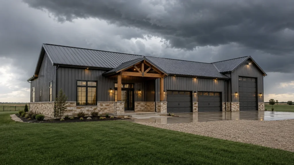
Drainage: The Risk Outside the Flood Zone
Many drainage problems happen on land that is not in any mapped floodplain. Heavy rain, clay soil that drains slowly and poorly placed buildings can all send water where you do not want it.
Look for these signs on a parcel:
- Low spots that hold standing water after rain
- Gullies, erosion channels or washed-out areas
- Dry creek beds or drainage paths crossing the building site
- Water flowing onto the parcel from a road or neighboring land
- Wet-tolerant vegetation in areas that look dry
Visiting the land during or after a heavy rain is one of the best ways to see how water actually moves.
Regional Drainage Differences
Drainage challenges change across the state. Southeast Oklahoma includes mountains, river valleys and some of the state’s highest rainfall, so slopes and runoff often drive the site plan.
In Northeast Oklahoma, wooded, rolling land and creeks call for careful pad placement and culvert planning. Drier western parcels still need grading, because hard rain on dry ground can run off quickly.
How Drainage Shapes a Barndominium Site Plan
A good site plan works with the land’s natural drainage instead of fighting it. The building pad, driveway, septic field and outbuildings all need to fit around the way water moves. Recorded easements and any oil and gas activity can also take parts of the land off the table, so check mineral rights, surface rights and easements before fixing the site plan.
- Set the slab high enough that the ground slopes away on every side
- Keep the home out of natural drainage paths and away from low spots
- Size culverts under driveways for heavy rain events
- Direct gutters and downspouts well away from the foundation
- Keep the septic dispersal area out of wet or flood-prone ground
Large barndominium roofs collect a lot of water, especially with a shop attached. Planning where that water goes belongs in the design stage, alongside the barndominium floor plans for Oklahoma you choose, not after the steel goes up.
Want drainage planned into your site from the start?
Questions to Ask the Local Floodplain Administrator
The floodplain administrator is the most direct source of local answers. A short call or email before you buy can save weeks of redesign later.
- Which flood maps apply to this parcel, and are any map updates in progress?
- Does the community require the lowest floor to sit above the Base Flood Elevation, and by how much?
- Is a floodplain development permit needed for grading, fill, driveways or outbuildings?
- Is any part of the parcel in a regulatory floodway?
- Are there known drainage problems or past flood claims near the property?
Get the answers in writing where possible. Rules differ between cities, towns and counties, and a parcel just outside city limits may fall under a different administrator than the town next door.
A Pre-Purchase Floodplain and Drainage Checklist
- Look up the FEMA flood map and note the flood zone at the building site
- Ask the local floodplain administrator whether local maps or rules are stricter
- Check for a floodway or drainage easement on the parcel
- Walk the land after heavy rain to see where water collects and flows
- Ask neighbors or the seller about past flooding
- Get a flood insurance quote if any part of the building site is in a flood zone
These checks take little time compared with the cost of moving a house pad later. Experienced barndominium builders in Oklahoma will ask for most of this information during land evaluation.
Floodplains in the Wider Oklahoma Build Process
Flood risk and drainage belong in the land evaluation stage, alongside soil, septic, access and zoning. A full-service barndominium builder can carry those findings into the site plan, foundation design and permits so nothing is missed between stages.
Our guide to building a barndominium in Oklahoma explains where this step fits in the full process.
Rainfall, terrain and local rules vary so much across the state that flood planning cannot follow one standard approach. We explore those differences in our article on what makes building a barndominium in Oklahoma different.
Conclusion
Flood risk in Oklahoma is a site-by-site question. Start with the FEMA flood map, confirm local rules with the floodplain administrator, and then look at how water actually moves across the land. Building in a floodplain is often possible, but it brings permits, elevation requirements and insurance costs that can usually be avoided by choosing higher ground. Outside mapped flood zones, good drainage design still protects the foundation, driveway and septic system for the life of the home.
Frequently Asked Questions
How do I find out if my Oklahoma land is in a floodplain?
Search the property address on the FEMA Flood Map Service Center to see the mapped flood zone. Then contact the local floodplain administrator, since some communities use stricter local maps or rules. Check the zone at the actual building site, not just the parcel.
Can you build a house in a flood zone in Oklahoma?
In many cases yes, with a floodplain development permit from the local community or county. Rules usually require the lowest floor to be at or above the Base Flood Elevation, and building in the floodway is tightly restricted. Flood insurance is generally required for federally backed mortgages in high-risk zones.
What does Zone AE mean on a flood map?
Zone AE is a high-risk flood area with a 1% annual chance of flooding where a Base Flood Elevation has been determined. Development in Zone AE usually needs a floodplain permit and elevation of the lowest floor.
Do I need flood insurance for a barndominium?
If the home is in a Special Flood Hazard Area and has a federally backed mortgage, flood insurance is generally required. Outside those areas it is usually optional, but standard homeowners policies typically do not cover flood damage.
What is an Elevation Certificate?
An Elevation Certificate is a FEMA form completed by a surveyor or engineer that documents a building’s elevation relative to the Base Flood Elevation. It is often required for floodplain permits and is used to rate flood insurance.